
In the main sequence, the concept of international waters was determined by
a bunch of people a long time ago who talked about it for a long time, and
used math to make clear and mostly unequivocal calculations. In The Third
Rail, things went a little bit differently. For much of human history, if
one could see land using a normal handheld spyglass, they were floating
within territorial waters, and subject to that state’s laws and customs.
When two or more states could be viewed from the same point, those states
had to come to some kind of agreement, not subject to any outsider’s opinion
or authority on the matter. World War I in the 1850s predominantly concerned
how boundaries were divided, and who was entitled to what land resources.
Each dispute inspired two more fronts to pop up elsewhere, and settle their
own grievances. Pretty soon, the whole planet was on fire. The end of The
Terrible War—as it was known colloquially, especially at the time—was when
all of the major disagreements had been resolved. It was also when a new
definition of transboundary waters was established. Basically, if you could
defend it with a naval or coastal force, you could have it.
Since then, smaller wars have been fought over further discord, but they
were mostly not tied together, and World War II didn’t begin for another 140
years, which finalized a lot of the lingering border ambiguity through
treaties and trade agreements. Much of World War III in the 2040s involved
starting the argument over again, but this time regarding airspace, as that
was the innovation at the time. These laws have not technically changed over
the centuries, but the boundaries have naturally become standardized for the
majority of nations. It is strikingly similar to the figure used in the main
sequence. There, it’s 370 kilometers. Here, it’s 350 kilometers. Unless
you’re talking about Panama, where it’s closer to 900 kilometers.
Jamaica, Nicaragua, Costa Rica, Colombia, and Ecuador do not have
international waters to speak of. They only have a small sliver of internal
waters, which essentially come down to how far out a small fishing boat can
go for a day of work, and still make it back to shore by nightfall. The
wars, the peace negotiations, and the trade policies that led to this
interesting situation are impossible to explain on a single page, but the
details are irrelevant. Marie, Leona, and their SD6 team need to get into
Panama, but none of those other countries listed is willing to host them.
The closest they can get is a small island chain straddling the equator
called Xeros. Overlaying the correspondence map that Leona created onto this
reality’s map makes it obvious that in the main sequence, they’re called the
Galápagos Islands. There, they were named for the tortoises that call it
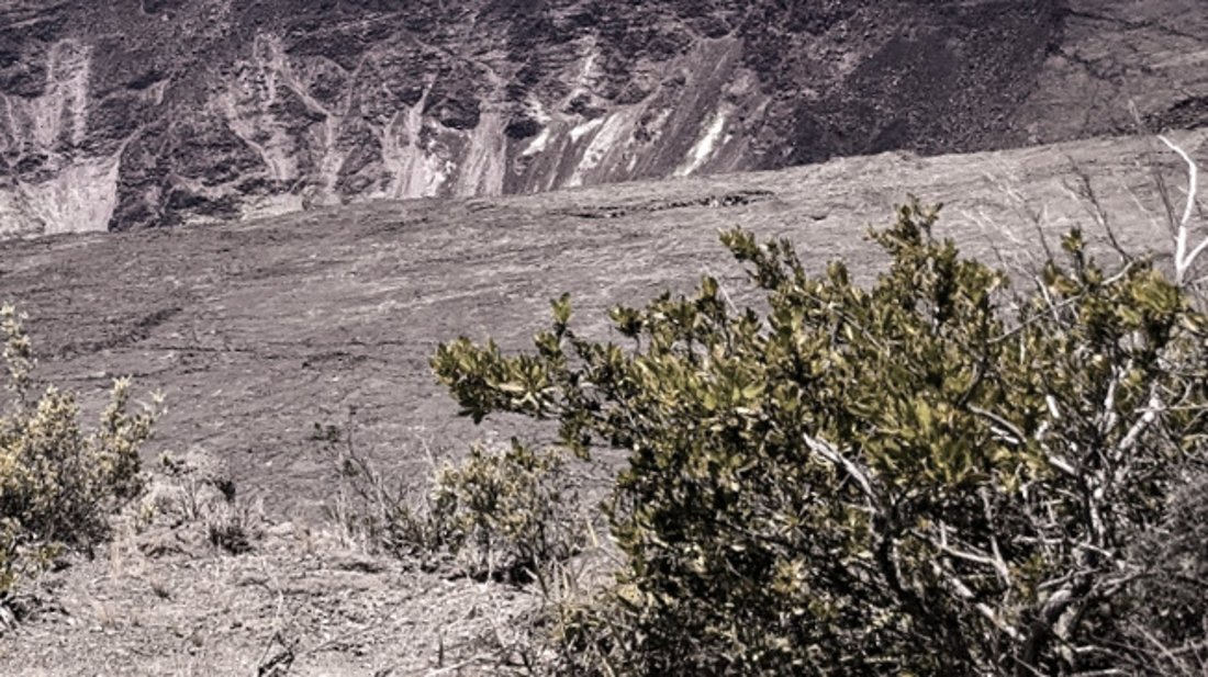
home. Here, they’re named for the fact that nothing lives here. The fauna,
and much of the flora, was decimated so long ago that the history books
don’t remember who was responsible, but they did such a good job of it that
these are mostly just made of rocks, sand, and a few shrubs here and there.
Tourism does not exist. At all. So at least they have some privacy while the
diplo team gets their diplomacy on.
“Hey. Hey look.” Doric has been playing games on his tablet in between
scanner updates. “I was right. The dot is definitely in the water now, and
closer than last time.”
Marie takes it from him. She looks out over the water, even though the dot
is still hundreds of kilometers away. “This looks like an escape pattern.
Our target is trying to get out of Panama. Piss and gear up. We’re going
in.”
No comments :
Post a Comment